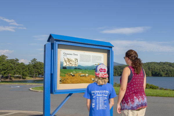
Gabe and Kris Yeomans take time while walking at Chatuge Dam to read the new Cherokee heritage informational sign near the parking lot at Chatuge Dam in Clay County. (CCCRA photos)
LAKE CHATUGE – In addition to sites along the Quanassee Path in Hayesville, people now have two more places to go to get information about the Cherokee and their communities, thanks to the Tennessee Valley Authority’s (TVA) partnership with Clay County Communities Revitalization Association (CCCRA).
People walking along Chatuge Dam can check out the information about Quanassee Town on the reverse side of the existing kiosk at the dam. The sign contains a 1721 English map with the location of Quanassee and other Cherokee communities that were in the upper Hiwassee River Valley, along with the description of a typical Cherokee town.
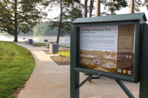
Additional informational kiosks may be found at the Chatuge Recreation Area after turning to the right about 2 miles along Hinton Center Road. At the end of the ¼ mile paved road, you will find a picturesque setting on Lake Chatuge, with paved parking, 10 picnic tables, grills, boat ramp and small beach with swimming area.
The photo shows a Cherokee heritage informational sign near the boat launching ramp at the “circle” near Chatuge Dam.
One kiosk describes Agusdogi, the Immortal Town, which was located where Shooting Creek came into the Hiwassee River. That location is now covered by the still waters of Chatuge Reservoir.
The other kiosk depicts Cherokee Life in the Old Aquohee District of the Cherokee Nation, a sovereign republic established in 1820, with the district courthouse located in the Peachtree area.
Erin Pritchard, TVA’s senior archaeological specialist, who was instrumental in installing the kiosks said, “Protecting the environment and preserving archaeological sites is a core mission at TVA. We are very grateful to the Clay County Communities Revitalization Association for reaching out to partner on these interpretive signs. This information will increase the community’s awareness on not only the historic significance of this region, but also the importance of protecting these places for future generations.”
Western Carolina University’s Sequoyah professor of Cherokee Studies Brett Riggs provided the text, graphics, and photos for these and other informational kiosks in Clay County. Riggs is well-known for providing expert commentary on archaeological research and preservation of Cherokee history and culture. He has served as a resource to CCCRA for approximately 10 years, providing guidance and expertise as the Cherokee Homestead Exhibit was developed, and writing the text for the Spikebuck Mound and Quanassee Town site kiosks. Riggs noted that the main sign is Agusdogi, and the artwork was done by T.J. Holland, a member of the Eastern Band of Cherokee Indians. This sign has QR code accessible audio with the story being told in the Cherokee language by Tom Belt, a Cherokee Nation citizen and fluent Cherokee speaker, and music provided by EBCI tribal member Matt Tooni.
To learn about the Quanassee Path, a 2-mile Cherokee History Trail that connects five sites in Hayesville, visit https://www.cccra-nc.org/.
– Clay County Communities Revitalization Association release